
Oregon’s Unusual Blizzard Warning Ends Amid Severe Snow Prediction
TL/DR –
The National Weather Service has issued a rare blizzard warning for Oregon’s Cascade mountain roads and passes due to projections of extreme snowfall and high winds on Tuesday and Wednesday. Up to 4 feet of snow and winds between 55 to 75 mph could create whiteout conditions around Cascade mountain passes including Santiam Pass, Willamette Pass, and the Mount Hood area. The combination of heavy snow, strong winds, and low temperatures could result in power outages, dangerous driving conditions, and potentially impact mountain roads in the Coast Range and Cascade Foothills.
Extreme Snow and High Winds Forecasted for Oregon Mountain Roads and Passes

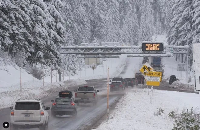
A rare blizzard warning has been issued by the National Weather Service (NWS) for Oregon passes, due to projected heavy snowfall and high winds.
Cascade mountain passes including Santiam Pass (Highway 20), Willamette Pass (Highway 58) and the Mount Hood area (Highway 26) could experience up to 4 feet of snow and winds between 55 to 75 mph, leading to whiteout conditions.
Potential Impact of Blizzard Conditions
Although snow is forecast through Monday in the Cascade Range passes, the blizzard warning is effective from 4 a.m. Tuesday. Heavy snow and strong winds could cause whiteout conditions and poor visibility, making driving conditions hazardous.
The warning also stated that the storm could result in downed tree limbs and power outages. The heaviest snowfall is expected above 3,000 feet, but snow levels may drop to 1,500 to 2,000 feet by Tuesday, impacting mountain roads in the Coast Range and Cascade Foothills.

Impact on Interstate Travel and Long-Term Forecast
The storm may also affect travel on Interstate 5 in southern Oregon, including potential snowfall at Sexton Summit and Siskiyou Summit at the state line with California. On a positive note, the storm may bring Oregon’s mountain snowpack up to normal levels, leading to the opening of all Oregon ski areas in the coming week.
Oregon’s 6-10 day forecast and 8-14 day forecast suggest that the cold and wet conditions are likely to persist.
—
Read More US News