
55k PG&E Customers Lack Power, Road Closures Continue
TL/DR –
The article discusses the current weather conditions and forecast for the Central Coast, including information about current temperatures, forecast high temperatures, and storm systems. It mentions that there are individual showers and storms present, which could lead to localized flooding, increased winds, and occasional lightning strikes. The weather is expected to become less impactful starting Tuesday, with rain showers lingering into the day before tapering off, and temperatures for the rest of the week struggling to rise above the mid- to upper-50s.
Meteorologist Gina DeVecchio Gives Weather Updates
Good morning! Here’s the current view outside and your present conditions. Current temperatures are displayed on the map, as well as forecast high temperatures across the state. Infrared satellite imagery shows current storm systems, clouds, and rain. The widespread rain has thinned, but showers and storms continue to move across the Central Coast, leading to localized flooding, increased winds, and some lightning.
Less impactful weather is expected from Tuesday onwards. This is the tail end event. More impactful storms, sparking lightning over San Mateo County and causing localized flooding along the coastal areas, have occurred. River flooding remains a risk into late morning, but some river rise rates are easing. Expect additional assessments from the local River Forecast Center mid morning. Hazardous winds are reducing, and wind warnings and advisories will expire in the mid morning.
From Monday night through to next Saturday, rain showers will linger into Tuesday before tapering off from north to south. Afternoon temperatures for the rest of the week are expected to struggle to rise out of the mid to upper 50s (40s for higher peaks), and overnight lows will range from the upper 30s to mid 40s. Rain may return by early Thursday morning, but no significant impacts are expected at this time. Drier conditions are forecasted for the upcoming weekend. The futurecast shows the temperature pattern for the next several days. Here are your forecast high temperatures for today and a look at your low temperatures and sky conditions for tomorrow morning.
Atmospheric River Update
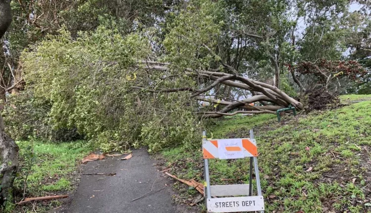
A powerful atmospheric river has led to strong winds, downed powerlines, trees, and road closures across the Central Coast. As of Monday morning, 55,000 PG&E customers in Santa Cruz County, Monterey County, and San Benito County were still without power. Click here for the latest information on power outages.
Storm damage and power outages led to school closures on the Central Coast on Monday. Roads were also closed in Santa Cruz County and Monterey County due to fallen trees, debris slides, and dangerous conditions.
All evacuation warnings and orders were lifted for Monterey County as of 10 a.m. Monday. Shelter-in-place orders were issued in areas of Arroyo Seco West of Carmel Valley Road and all of Pebble Beach on Sunday evening. Click here for the latest evacuation maps.
—
Read More US News